Моделирование полета дрона (облет ориентиров)
]add LinearAlgebra
]add Colors
using LinearAlgebra, Colors
Plots.PlotlyJSBackend()
const deltaH_mark=10
const θcam = 30
const steps_around_group = 24
const max_steps_around = 72
const min_radius_flyby = 1.0
const plateau = 10
const MaxSteps = 1000
const pract_ceiling = 33.0
const minh_over_terrain = 3.0
const descend_speed = 2.0
const steps_descend = 10
function generate_landscape(width_m, length_m)
    X = 0:1:width_m
    Y = 0:1:length_m

    Z = [10(sin(xi / 10) + cos(yi / 15)) + 5rand() + plateau for xi in X, yi in Y]
    Z = reverse(Z, dims=(1, 2))

    random_yi_start = rand(1:length(Y))
    random_yi_finish = rand(1:length(Y))
    xi_start = 10
    xi_finish = length(X)-10
    Start = [X[xi_start], Y[random_yi_start], Z[xi_start, random_yi_start] + minh_over_terrain]
    Finish = [X[xi_finish], Y[random_yi_finish], Z[xi_finish, random_yi_finish]]

    plt1 = surface(X, Y, Z', c=:terrain, xlabel="X (м)", ylabel="Y (м)", zlabel="Z (м)",
                            title="3D ландшафт", size=(800,800), legend=false, camera = (15, 85))
    scatter!(plt1, [Start[1]], [Start[2]], [Start[3]+deltaH_mark], marker=(:diamond), markersize=5, color=:orange)
    scatter!(plt1, [Finish[1]], [Finish[2]], [Finish[3]+deltaH_mark], marker=(:xcross), markersize=5, color=:red)
#    println(typeof(plt1))
    landscape = X, Y, Z, Start, Finish
#    return x, y, z, start, finish, plt
    return landscape, plt1
end
function generate_refpoints(ref_count, plt, ls_x, ls_y, ls_z,
                            refstartX=last(ls_x)÷5, refstartY=last(ls_y)÷5,
                            refendX=last(ls_x)-refstartX, refendY=last(ls_y)-refstartY)
    RefPoints = Tuple{Int64, Int64, Float64}[]

    for _ in 1:ref_count
        xi = rand(refstartX:refendX)
        yi = rand(refstartY:refendY)
        zi = ls_z[xi, yi]
        push!(RefPoints, (xi, yi, zi))
        scatter!(plt, [xi], [yi], [zi+deltaH_mark], marker=(:circle), color=:yellow)
    end
#    println("refpoints:", refpoints)
#    println("Type of refpoints:", typeof(refpoints))
    return RefPoints
end
function put_start_finish(X, Y, Z, plt)
    random_yi_start = rand(1:length(Y))
    random_yi_finish = rand(1:length(Y))
    xi_start = 10
    xi_finish = length(X)-10
    Start = [X[xi_start], Y[random_yi_start], Z[xi_start, random_yi_start]]
    Finish = [X[xi_finish], Y[random_yi_finish], Z[xi_finish, random_yi_finish]]
    scatter!(plt, [Start[1]], [Start[2]], [Start[3]+3], marker=(:circle), color=:green)
    scatter!(plt, [Finish[1]], [Finish[2]], [Finish[3]+3], marker=(:circle), color=:red)
    display(plt)
    return Start, Finish
end

LScape, plt = generate_landscape(150, 150)
Xls, Yls, Zls, Start, Finish = LScape
maxdepth = Base.minimum(Zls)
maxheight = Base.maximum(Zls)
RefPts = generate_refpoints(45, plt, Xls, Yls, Zls)
#println("Type of refs:", typeof(RefPts))
display(plt)
println("max_h=", maxheight)
println("max_d=", maxdepth)
Дрон имеет бортовую камеру, смотрящую вертикально вниз, с заданным углом обзора 2θ, которая отслеживает попадание ориентиров в поле своего обзора. Если по пути движения дрона камера засекает ориентир, дрон изменяет траекторию так, чтобы облететь этот ориентир по оптимальной траектории (не уменьшая высоту полета, производит облет по оптимальному радиусу в оптимальном направлении). После облета ориентир добавляется в список обнаруженных, и дрон далее продолжает полет в направлении цели по первоначальному алгоритму облета препятствий. Требуется рассчитывать область пересечения поверхностей обзора камеры дрона и ландшафта в каждой точке траектории дрона, а также проверять, принадлежат ли координаты ориентира рассчитанной области пересечения по компонентам (x, y), хотя на практике такая задача вообще отсутствует - камера либо видит ориентир, либо нет. Задача также включает в себя подзадачу нахождения затенений ландшафтом низкорасположенных ориентиров. Представляет интерес поведение дрона при близком расположении ориентиров или попадании нескольких в поле камеры.
Упрощенный вариант вычисления поля камеры (не реализован)
Для координаты z ориентира вычисляется вероятность его обнаружения, заданная соотношением P(h) = Pmin * (1/Pmin)^(h/hmax), где hmax=maxheight - maxdepth, а h = z_ref - maxdepth. Все координаты ориентиров проверяются на предмет попадания внутрь поля обзора в плоскости (x,y) с учетом вероятности их обнаружения. Вероятность 1 соответствует диаметру обзора в основании конуса с координатой z_ref = maxheight ориентира. Pmin - вероятность обнаружения ориентира на максимальной глубине ландшафта.
(x_ref - x0)^2 + (y_ref - y0)^2 <= (1/4) * [2cone_r*(z0 - z_ref)/cone_h]^2 * P(h)
Обнаруженный ориентир облетается дроном по оптимальной траектории. Задача - получить наиболее гладкую траекторию по (x,y,z) компонентам.
function camera_beam(x0, y0, z0, θ)
    n=128

    cone_h = z0-maxdepth
    tanθ = 0
#    try
    if (Base.abs(θ) < 89.0)
        tanθ = tand(θ)
    else
#    catch
#        println("Поймана ошибка: ", e)
        return nothing
    end

    cone_r = cone_h*tanθ

    cone_base = LinRange(0, cone_r, n)
    z = LinRange(0, 1, n)
#    z = LinRange(0, cone_h, n)
    ϕ = LinRange(0, 2π, n)

    println("cone_h=", cone_h)
    println("cone_r=", cone_r)
    println("cone_base=", cone_base)
    println("z=", z)

    x1 = x0.+ [u * cone_r * cos(v) for u in z, v in ϕ]
    y1 = y0.+ [u * cone_r * sin(v) for u in z, v in ϕ]
    z1 = z0.+ [-cone_h*u for u in z, _ in ϕ]
#    z1 = z0.+ [-u for u in z, _ in ϕ]
    cone_plt = Plots.surface(x1, y1, z1, c=:jet, legend=false, size=(600,600), cbar=:none)
#    return z1
end

#cone_surf_z = camera_beam(30,40,50,θcam)
using Interpolations
function calc_refpoints_visible(ownposition, Z_ls, θ, Refs::AbstractVector{<:Tuple})
    n = 256

    x0, y0, z0 = ownposition
    z = LinRange(maxheight, maxdepth, n)
    θ = Base.abs(θ)

    refpts_detected = Tuple{Int64, Int64}[]
    pt_cntr = 0
    for t in Refs
#        println("Ref[]= ", t)
        Sref = sqrt((t[1] - x0)^2 + (t[2] - y0)^2)
#        println("Sref=", Sref)

        if (z0 < t[3])  # if drone position is lower than z-coordinate of a refpoint
            continue    # then don't take this refpoint
        end

        tanψ = +Inf
        try
            tanψ = Sref / (z0-t[3])
        catch
            continue
        end

#        println("tanψ=",tanψ)
        if (Base.abs(tanψ) < tand(θ)) && (Sref > 0)
            cosϕ = (t[1]-x0) / Sref
            sinϕ = (t[2]-y0) / Sref

#            println("cosϕ=", cosϕ)
            for i in 1:n
#                println("z[i]=", z[i])
                Sk = (z0 - z[i]) * tanψ
                xk = x0 + Sk*cosϕ
                yk = y0 + Sk*sinϕ
                xk1 = trunc(Int64, floor(xk))
                xk2 = trunc(Int64, ceil(xk))
                yk1 = trunc(Int64, floor(yk))
                yk2 = trunc(Int64, ceil(yk))
#                println(xk1, " ", yk1)
#                println(xk2, " ", yk2)

                Vicinity = [Z_ls[xk1, yk1] Z_ls[xk2, yk1];
                            Z_ls[xk1, yk2] Z_ls[xk2, yk2]]
                itp = interpolate(Vicinity, BSpline(Linear()))
                if (xk1 == xk2) && (yk1 == yk2)
                    idxX = 1
                    idxY = 1
                elseif (xk1 == xk2)
                    idxX = 1
                    idxY = 1+Base.abs((yk-yk1)/(yk2-yk1))
                elseif (yk1 == yk2)
                    idxY = 1
                    idxX = 1+Base.abs((xk-xk1)/(xk2-xk1))
                else
                    idxX = 1+Base.abs((xk-xk1)/(xk2-xk1))
                    idxY = 1+Base.abs((yk-yk1)/(yk2-yk1))
                end

                vzLS = itp(idxX, idxY)

                if (z[i] <= vzLS)
#                    println("(xk1,yk1):", xk1, " ", yk1)
#                    println("(xk2,yk2):", xk2, " ", yk2)

                    dist = sqrt((xk - t[1])^2 + (yk - t[2])^2)
                    if (dist < sqrt(2))
                        push!(refpts_detected,(t[1], t[2])) #store (x,y) coordinates of a refpoint
#                        println("--> pt_cntr[i]: ", pt_cntr, "[", i, "]", " caught refpt[", t[1],",", t[2], "]")
                        pt_cntr += 1
                    else
#                        println("xk=", xk)
#                        println("yk=", yk)
#                        println("dist = ", dist)
                        println("Landscape hedge blocks a refpt[$(t[1]),$(t[2])]\n")
                    end

#                    println("Vicinity=", Vicinity)
#                    println("vzLS=", vzLS)
#                    println("z[i]=", z[i])
#                    println("\n")
                    break
                end
            end
        else
#            println("Contitions are not met!\n")
        end
    end
    return refpts_detected
end
function Calc_Radius_Increment( radius, curr_pos, RefCenter, RefPts::AbstractVector{<:Tuple} )
    radius_flyby_inc = 0.0
    curr_posX, curr_posY = curr_pos
    ref_cenX, ref_cenY = RefCenter

    RefCen_vec = [ref_cenX - curr_posX, ref_cenY - curr_posY]

#    RefPts_XY = first.(RefPts)

    for t in RefPts
        ref_point = first.(t)
#        println("ref_point=", ref_point)
        EachRefPt_vec = [ref_point[1] - curr_posX, ref_point[2] - curr_posY]
        dot_pr = dot(RefCen_vec, EachRefPt_vec)
        if (dot_pr < 0)
            radius_flyby_inc = 1.2 * radius / steps_around_group
            println("radius flyby increment", radius_flyby_inc)
            break
        end
    end

    return radius_flyby_inc
end
function calc_Distances( arrA::AbstractVector{<:Tuple}, pos )
    Distances = sqrt.( (first.(arrA) .- first(pos)).^2 + (last.(arrA) .- last(pos)).^2 )
    return Distances
end
function calcGroup_CenterXY(Pts_group::AbstractVector{<:Tuple})
    radius = 0.0
    Group_Center = Tuple{Float64, Float64}

    if !isempty(Pts_group)
        RefPts_grp_xy = first.(Pts_group) # extract x,y coorduinates
        RefPts_grp_x = map(t -> t[1], RefPts_grp_xy)
        RefPts_grp_y = map(t -> t[2], RefPts_grp_xy)
        Group_Center = (sum(RefPts_grp_x)/length(RefPts_grp_xy),
                         sum(RefPts_grp_y)/length(RefPts_grp_xy)) # found a geometric center of a group of points or one point

        if length(Pts_group) > 1 # fly around a group, calculate radius of flying around
            println("<c> Group_Center=", Group_Center)
#            println("<c> first.(Pts_group)=", first.(Pts_group))

            tmp = first.(Pts_group)
            RefPts_distances = sqrt.( (first.(tmp) .- first(Group_Center)).^2 +
                                      (last.(tmp) .- last(Group_Center)).^2 )

#            println("<c> RefPts_distances=", RefPts_distances)
            radius = 1.1 * maximum(RefPts_distances)
            println("<c> flying radius=", radius)
        end
#    else
#        println("ERROR array Pts_group size")
    end

    return radius, Group_Center
end
function Get_Refpts_byRefGroup( AllRefPts::AbstractVector{<:Tuple}, group )
    RefPts_grp = Tuple{Tuple{Int64, Int64}, Int64}[] #  === DEBUG === option for get a group quickly
    RefPts_center = Tuple{Float64, Float64}

    flying_radius = 0.0
#    println("AllRefPts=", AllRefPts)
#    println("get by group:", group)

    if !isempty(AllRefPts)
        for p in AllRefPts
            if last(p) == group  # if the group of RefPts[i] is equal to given
                push!(RefPts_grp, p)
            end
        end

        flying_radius, RefPts_center = calcGroup_CenterXY(RefPts_grp)
#        println("RefPts_grp = ", RefPts_grp, "\n")
    end

    return RefPts_grp, RefPts_center, flying_radius
end
function Get_Refpts_byRefPts( AllRefPts::AbstractVector{<:Tuple}, Detected_Refs::AbstractVector{<:Tuple}, Flown_gr::AbstractVector{<:Int64}, curr_pos )
    RefPts_grp = Tuple{Tuple{Int64, Int64}, Int64}[] #  === DEBUG === option for get a group quickly
    RefPts_center = Tuple{Float64, Float64}

    flying_radius = 0.0
#    println("AllRefPts=", AllRefPts)

    if !isempty(AllRefPts)
        RefPts_XY = first.(AllRefPts)

        for p in Detected_Refs
            if (p in RefPts_XY)
#                println("Get by coords: ", p)
                idx = findall(x -> x == p, RefPts_XY)
#                println("idx=", idx)

                if (length(idx) == 1) # each detected point must have been added earlier in one group only!
                    group = last(AllRefPts[idx[1]])

                    if isempty(Flown_gr)
                        point = (p, last(AllRefPts[idx[1]]) )
                        push!( RefPts_grp, point )
                    elseif !(group in Flown_gr)
                        point = (p, last(AllRefPts[idx[1]]) )
                        push!( RefPts_grp, point )
                    end
                else
                    println("!!! ERROR of Refpoints Group numbering")
                end

            end
        end

        if ( length(RefPts_grp) > 1 )
#            println("RefPts_grp=", RefPts_grp)
            Groups = last.(RefPts_grp)
            elem1 = Groups[1]
#            println("------->Groups = ", Groups)

            if !all(x -> x==elem1, Groups) # if there are different groups in array, then keep only the clothest point and its group
                Distances = calc_Distances(first.(RefPts_grp), curr_pos)
#                println("Distances = ", Distances)

                idx = argmin(Distances)

                grp = last(RefPts_grp[idx])
                RefPts_grp = filter!( x -> (last(x)==grp), RefPts_grp)
#            else
#                println("ALL ELEMENTS ARE EQUAL!")
            end
        end

        flying_radius, RefPts_center = calcGroup_CenterXY(RefPts_grp)

#        if !isempty(RefPts_grp)
#            println("RefPts_grp = ", RefPts_grp, "\n")
#        end
    end

    return RefPts_grp, RefPts_center, flying_radius
end
function simulate_drone(Landscape, h_over_lscape, service_ceiling, speed; fov_angle=45.0, view_distance=10.0)
    if (h_over_lscape * service_ceiling <= 0) || (service_ceiling <= plateau) # nonsense conditions
        return
    end
    X, Y, Z, Start, Finish = Landscape

    if (Start[3] > service_ceiling)
        println("!!! Flight started too high: ceiling = $(service_ceiling), started at $(Start[3])")
    end

    drone_path = [copy(Start)]
    drone_heights = [Start[3]]
    gnd_height_below = [Start[3]]
    obstacles = [[]]
    dir_around = [0.0, 0.0]
    direction = [0.0, 0.0]
    curr_direction = [0.0, 0.0]
    curr_speed = speed
    #stack_of_dir = []

    All_RefPts = Tuple{Tuple{Int64, Int64}, Int64}[]
    RefPts_Group = Tuple{Tuple{Int64, Int64}, Int64}[]
    RefPtsGr_center = Tuple{Float64, Float64}
    FlownGroups = Int64[]

    curr_group = ref_group = 0
    radius_flyby = 0.0
    radius_flyby_inc = 0.0
    min_refpt_dist = -Inf
    Φr = 0.0
    steps_around = 0

    current_pos = copy(Start)
    for _ in 1:MaxSteps
        if norm(current_pos[1:2] .- Finish[1:2]) < curr_speed
            break
        end

        direction = normalize(Finish[1:2] .- current_pos[1:2]) # always estimate targer direction
        Detected_Refs = calc_refpoints_visible(current_pos, Z, θcam, RefPts)

        if !isempty(Detected_Refs)  # if refpoints have been detected

            ref_points_xy = first.(All_RefPts)                     # extract coordinates x,y from array of All_RefPts detected before

            added_newpts = 0

            for i in 1:length(Detected_Refs)                       # by one check if coordinates of the detected points are already in All_RefPts
                if ((Detected_Refs[i] in ref_points_xy) == false)  # if these refpoints are new ones
                    added_newpts += 1
                    push!(All_RefPts, (Detected_Refs[i], ref_group+1)) # push them by one into All_RefPts with (ref_group+1) for all of them
                end
            end

            if (added_newpts > 0)
                ref_group += 1
            end

            if (curr_group == 0) # if fly towards the target, then can process detected points
                if (added_newpts > 0) # get new refpoints by their group
                    RefPts_Group, RefPtsGr_center, radius_flyby = Get_Refpts_byRefGroup(All_RefPts, ref_group)

                    if (added_newpts != length(RefPts_Group))
                        println("!!! ERROR of extracting Group of refpoints")
                    end
                else # get refpoints that were former detected by coords (and get their group)
                    RefPts_Group, RefPtsGr_center, radius_flyby = Get_Refpts_byRefPts(All_RefPts, Detected_Refs, FlownGroups, (current_pos[1], current_pos[2]))
                end
            end #else continue our flying around detected group of refpoints
        else
#            println("RefPts_Group=", RefPts_Group)
        end

        if (curr_group == 0)

            next_pos = current_pos[1:2] .+ direction * curr_speed  # calc next_pos as we wouldn't have refpopints
            next_pos[1] = clamp(next_pos[1], X[1], X[end])
            next_pos[2] = clamp(next_pos[2], Y[1], Y[end])

            if (length(RefPts_Group) > 0)  # must fly around something
                dist_to_refcenter = sqrt( (current_pos[1] - RefPtsGr_center[1])^2 + (current_pos[2] - RefPtsGr_center[2])^2 )  # found distance to ref. center

                if (min_refpt_dist < 0)  # set the first actual value of distance from current position to the center of refpoints
                    min_refpt_dist = dist_to_refcenter
                elseif (dist_to_refcenter < min_refpt_dist) # if distance is decreasing, then approach as close as possible
                    min_refpt_dist = dist_to_refcenter # update the shortest distance to center
                else #the distance to ref. center is increasing again
                    if (length(RefPts_Group) == 1) # fly around a single refpoint
                        if (min_refpt_dist >= min_radius_flyby) # only if it is little aside from us, not too close
                            curr_group = last.(RefPts_Group)[1] # set a new curr_group, so this group becomes now the actually flying around
                            radius_flyby = min_refpt_dist
                            println("--> Start now flying around single refpoint ", RefPts_Group[1])
                        else # otherwise if we are too close to the center of refpoints/single refpoint
                            empty!(RefPts_Group) # clear the ignored reference point
                            min_refpt_dist = -Inf
                            println("--> Ignored a single refpoint - too close!")
                        end
                    else # otherwise if flying around a group of refpoints
                        if (radius_flyby <= min_radius_flyby)
                            empty!(RefPts_Group) # clear the ignored reference point
                            min_refpt_dist = -Inf
                            println("--> Ignored a group of refpoints - too close!")
                        else #if (dist_to_refcenter >= radius_flyby) # if the distance from current position to ref. center exceeded the flyby radius
                            curr_group = last.(RefPts_Group)[1] # set a new curr_group, so this group becomes now the actually flying around

                            radius_flyby_inc = Calc_Radius_Increment(radius_flyby, (current_pos[1], current_pos[2]), RefPtsGr_center, RefPts_Group)

                            println("--> Start now flying around a group of refpoints with center in ", RefPtsGr_center)
                        end
                    end
                end

                if (curr_group > 0) #if flying around is started, find isparameters
                    min_refpt_dist = -Inf #reset min distance to the ref. center
                    Φr = 2π / steps_around_group

                    ref_cen = [RefPtsGr_center[1], RefPtsGr_center[2], 0]
                    dir_xy = [direction[1], direction[2], 0]
                    curr_pos_xy = copy(current_pos)
                    curr_pos_xy[3] = 0

                    cross_product = cross(dir_xy, ref_cen .- curr_pos_xy)
                    if (cross_product[3] < 0)
                        Φr = -Φr
                        println(">>> Clockwise flight")
                    else
                        println("<<< Counterclockwise flight")
                    end
                    steps_around = 0
                end
            end
            curr_direction = direction
        end

        if (curr_group > 0)  # if fly around is started,
            radius_flyby += radius_flyby_inc

            curr_speed = 2π*radius_flyby / steps_around_group

            dir_around = [curr_direction[1]*cos(Φr) - curr_direction[2]*sin(Φr),
                          curr_direction[1]*sin(Φr) + curr_direction[2]*cos(Φr)]
            dir_around = normalize(dir_around)
            dot_product = dot(dir_around, direction)
#            println("dot_product=", dot_product)

            steps_around += 1
            next_pos = current_pos[1:2] .+ dir_around[1:2] * curr_speed  # calc next_pos as we wouldn't have refpopints
            next_pos[1] = clamp(next_pos[1], X[1], X[end])
            next_pos[2] = clamp(next_pos[2], Y[1], Y[end])
            curr_direction = dir_around

            if (norm(direction) * norm(curr_direction) - dot_product < 0.005) || (steps_around > max_steps_around) # about 5 degrees for cos(x)
                push!(FlownGroups, curr_group)
                curr_group = 0
                radius_flyby_inc = 0.0
                curr_speed = speed
                empty!(RefPts_Group)
                println("Flown around in $(steps_around) steps\n")
                steps_around = 0
                continue
            end

        end

        xi = argmin(abs.(X .- next_pos[1])) # find next position of drone on the grid
        yi = argmin(abs.(Y .- next_pos[2]))
        terrain_height = Z[xi, yi] # terrain height in the next planned position

        if (current_pos[3] >= service_ceiling) # still flying higher than our ceiling permits (e.g. started there)
#            new_z = min(current_pos[3], terrain_height + h_over_lscape)
            if (terrain_height + h_over_lscape < service_ceiling)
                new_z = terrain_height + h_over_lscape
            else
                new_z = service_ceiling
            end
#            new_z = clamp( max(current_pos[3], terrain_height + h_over_lscape), -Inf, service_ceiling )
        else
            new_z = clamp( min(terrain_height + h_over_lscape, current_pos[3]), -Inf, service_ceiling )
        end

        visible_obstacles = Tuple{Float64, Float64, Float64}[]

        for angle in range(-fov_angle/2, fov_angle/2, length=12)
            rad = deg2rad(angle)

            dir = [curr_direction[1]*cos(rad) - curr_direction[2]*sin(rad),
                   curr_direction[1]*sin(rad) + curr_direction[2]*cos(rad)]

            for b in range(1.0, view_distance, length=2*trunc(Int64, floor(view_distance)))
                check_pos = next_pos .+ dir * b

                xi_check = argmin(abs.(X .- check_pos[1]))
                yi_check = argmin(abs.(Y .- check_pos[2]))

                if 1 ≤ xi_check ≤ size(Z, 1) && 1 ≤ yi_check ≤ size(Z, 2)
                    obstacle_height = Z[xi_check, yi_check]

                    if obstacle_height > new_z # obstacle is higher than our ceiling
                        push!(visible_obstacles, (X[xi_check], Y[yi_check], obstacle_height))
                    end
                end
            end
        end

        if !isempty(visible_obstacles)
#            if (current_pos[3] >= service_ceiling)
#                min_obstacle = minimum(obs[3] for obs in visible_obstacles)
#            else
                max_obstacle = maximum(obs[3] for obs in visible_obstacles)
                min_obstacle = minimum(obs[3] for obs in visible_obstacles)

                if (max_obstacle + h_over_lscape > service_ceiling)
#=
                    orth_dir = curr_direction
                    if rand() < 0.5
                        orth_dir = [-curr_direction[2] curr_direction[1]]
                    else
                        orth_dir = [curr_direction[2] -curr_direction[1]]
                    end

                    next_pos = current_pos[1:2] .+ orth_dir * curr_speed  # move orthogonal instead of towards the curr_direction
                    next_pos[1] = clamp(next_pos[1], X[1], X[end])
                    next_pos[2] = clamp(next_pos[2], Y[1], Y[end])
=#
                    next_pos[1] = clamp(next_pos[1] + rand([-0.7, 0.7]) * curr_speed, X[1], X[end])
                    next_pos[2] = clamp(next_pos[2] + rand([-0.7, 0.7]) * curr_speed, Y[1], Y[end])
                    new_z = clamp( current_pos[3] + descend_speed, -Inf, service_ceiling )
                elseif max_obstacle + h_over_lscape > new_z
                    new_z = clamp( max_obstacle + h_over_lscape, -Inf, service_ceiling )
                end
#            end
        end

        current_pos = [next_pos[1], next_pos[2], new_z]
        push!(drone_path, copy(current_pos))
        push!(drone_heights, new_z)

        xi = argmin(abs.(X .- next_pos[1])) # find next position of drone on the grid
        yi = argmin(abs.(Y .- next_pos[2]))
        push!(gnd_height_below, Z[xi,yi])

        push!(obstacles, visible_obstacles)
    end

    if (length(drone_path) > MaxSteps)
        println("CRASHED - Fuel is over!!!")
    else
        xi_end = argmin(abs.(X .- Finish[1]))
        yi_end = argmin(abs.(Y .- Finish[2]))
        final_ground = Z[xi_end, yi_end]

        for _ in 1:steps_descend
            new_z = drone_path[end][3] - (drone_path[end][3] - final_ground) / steps_descend
            push!(drone_path, [Finish[1], Finish[2], new_z])
            push!(drone_heights, new_z)
            push!(gnd_height_below, final_ground)
            push!(obstacles, [])
        end
    end
    println("Время полёта дрона: $(length(drone_path)) шагов")
    println("FlownGroups: ", FlownGroups)
    println("All visible Ref. points: ", All_RefPts)

    return drone_path, drone_heights, gnd_height_below, obstacles, Start, Finish, All_RefPts
end

println("Start position of drone: ", Start)
println( "Terrain height at start = ", Zls[trunc(Int64, Start[1]), trunc(Int64, Start[2])] )
speed = 1
drone_path, drone_heights, gnd_height, obstacles, start, finish, refs = simulate_drone(LScape, minh_over_terrain, pract_ceiling, speed)

path_x = [p[1] for p in drone_path]
path_y = [p[2] for p in drone_path]
path_z = [p[3] for p in drone_path]

plt1 = plot(path_x, path_y, lw=2, c=:blue, xlabel="X (м)", ylabel="Y (м)", title="Путь дрона", legend=false)
scatter!(plt1, [path_x[1]], [path_y[1]], marker=:diamond, markersize=6, color=:orange)
scatter!(plt1, [path_x[end]], [path_y[end]], marker=:xcross, markersize=6, color=:red)

#plt2 = plot(t, path_z, lw=2, c=:purple, xlabel="Шаги", ylabel="Высота (м)", title="Высоты дрона", legend=false)
plt2 = plot(path_x, path_y, path_z, lw=2, c=:purple, xlabel="X (м)", ylabel="Высота (м)", title="Путь дрона в 3D", legend=false, camera = (-15, 5))

scatter!(plt2, [path_x[1]], [path_y[1]], [path_z[1]], marker=:diamond, markersize=4, color=:orange)
scatter!(plt2, [path_x[end]], [path_y[end]], [path_z[end]], marker=:xcross, markersize=4, color=:red)

for p in 1:length(RefPts)
    scatter!(plt1, [RefPts[p][1]], [RefPts[p][2]], marker=:circle, markersize=3, color=:yellow)
    scatter!(plt2, [RefPts[p][1]], [RefPts[p][2]], [RefPts[p][3]], marker=:circle, markersize=3, color=:yellow)
end
#=
for (name, rgb_tuple) in Colors.color_names
    println("$name: $rgb_tuple")
end
=#
my_color = colorant"goldenrod1"

refs_coords = first.(refs)
for p in 1:length(refs_coords)
    scatter!(plt1, [refs_coords[p][1]],[refs_coords[p][2]], marker=:circle, markersize=5, color=my_color)
    scatter!(plt2, [refs_coords[p][1]], [refs_coords[p][2]], [Zls[refs_coords[p][1], refs_coords[p][2]]], marker=:circle, markersize=5, color=my_color)
end

t = 1:length(drone_path)# - steps_descend

ceiling = [pract_ceiling for p in t]
plt3 = plot(t, ceiling, lw=2, c=:DeepSkyBlue, legend=true, label="потолок", xticks=1:1:length(path_z), xformatter=(_...) -> "")
plt3 = plot!(t, path_z, lw=2, c=:purple, xlabel="Шаги, 1 шаг", ylabel="Высота (м)", title="Высота дрона и рельефа", legend=true, label="дрон")
plt3 = plot!(t, gnd_height, lw=2, c=:grey, legend=true, label="рельеф", yticks= trunc(Int64, floor(maxdepth)):2:max(pract_ceiling, trunc(Int64, ceil(maxheight))))

l = @layout([a b; c])
plot(plt1, plt2, plt3, layout=l, size=(1200, 1200))

#display(plt3)
#plot(plt3, plt4, layout=(1, 1), size=(1000, 1000))
gr()
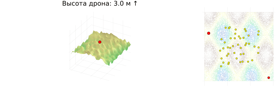
function visualize_flight(landscape, drone_path, drone_heights, obstacles, speed, start, finish; fps=10)
x, y, z = landscape
xidx = Dict(px => argmin(abs.(x .- px)) for px in unique(p[1] for p in drone_path))
yidx = Dict(py => argmin(abs.(y .- py)) for py in unique(p[2] for p in drone_path))
base_surface = surface(x, y, z', c=:terrain, legend=false, aspect_ratio=:auto, axis=false)
base_2d = plot(aspect_ratio=1, legend=false, axis=false)
contour!(base_2d, x, y, z', c=:terrain, alpha=0.3)
scatter!(base_surface, [start[1]], [start[2]], [start[3]], marker=:circle, markercolor=:green, label=false)
scatter!(base_surface, [finish[1]], [finish[2]], [z[end, end]], marker=:circle, markercolor=:red, label=false)
for p in 1:length(RefPts)
scatter!(base_surface, [RefPts[p][1]], [RefPts[p][2]], marker=:circle, markersize=3, color=:yellow)
end
scatter!(base_2d, [start[1]], [start[2]], marker=:circle, markercolor=:green)
scatter!(base_2d, [finish[1]], [finish[2]], marker=:circle, markercolor=:red)
for p in 1:length(RefPts)
scatter!(base_2d, [RefPts[p][1]], [RefPts[p][2]], marker=:circle, markersize=3, color=:yellow)
end
anim = @animate for i in 1:length(drone_path)
plt1 = deepcopy(base_surface)
plt2 = deepcopy(base_2d)
px, py, pz = drone_path[i]
scatter!(plt1, [px], [py], [pz], markersize=5, markercolor=:red, marker=:circle)
xlims!(plt1, px - 10, px + 10)
ylims!(plt1, py - 10, py + 10)
xi, yi = xidx[px], yidx[py]
height_above = pz - z[xi, yi]
arrow = i == 1 ? "↑" : (height_above > (drone_path[i - 1][3] - z[xidx[drone_path[i - 1][1]], yidx[drone_path[i - 1][2]]]) ? "↑" : "↓")
title!(plt1, "Высота дрона: $(floor(height_above)) м $arrow")
if i > 1
path = drone_path[1:i]
plot!(plt2, [p[1] for p in path], [p[2] for p in path], linewidth=2, linecolor=:blue)
end
scatter!(plt2, [px], [py], markersize=5, markercolor=:red)
if !isempty(obstacles[i])
obs_x = [o[1] for o in obstacles[i]]
obs_y = [o[2] for o in obstacles[i]]
obs_z = [o[3] for o in obstacles[i]]
scatter!(plt1, obs_x, obs_y, obs_z, markersize=3, markercolor=:yellow, marker=:xcross)
scatter!(plt2, obs_x, obs_y, markersize=3, markercolor=:yellow, marker=:xcross)
end
plot(plt1, plt2, layout = @layout([a{0.7w} b]), size=(900, 300))
end every max(1, round(Int, 1/speed))
gif(anim, fps=fps)
end
visualize_flight(LScape, drone_path, drone_heights, obstacles, speed, Start, Finish; fps=5)